Home / Photo Gallery / 2017 / Day to Day life as an Aerial Sensor Operator
Day to Day life as an Aerial Sensor Operator
Working as an Aerial Sensor Operator is equal parts excitement and boredom. Survey work, whether it is color imagery or LiDAR, takes a pilot/operator crew all over the country for days or weeks at a time, flight planning is a challenge in balancing efficiency with aircraft capability, the sensors must be maintained, errors troubleshot and fixed, and the collected data must be checked for quality and completeness in real-time and post-flight. On the other hand, even a small cloud bank over a project area can ground a mission for hours or days, fragile sensor units can break and days can be spent waiting for replacement parts or tech support.
Since being hired as a Sensor Operator in January 2017 by Aero-Graphics, LLC based in Salt Lake City, UT, I have travelled to Orange County, California, Las Vegas, Oregon, Idaho, Kansas, Arkansas and everywhere in between. I have worked from the Mississippi River to the Pacific Ocean, the Canadian Border to Mexico. I have crossed the Grand Canyon 6 times and flown the entire length of the Snake River from Jackson Hole to the Columbia, and collected images from altitudes of 1000 feet above the ground to the high altitudes of 22,000 feet.
There is not one “typical” day as a Sensor Operator, but generally work days can be divided into one of three types: on the road, maintenance and office. The most common are on the road, doing the primary work of collecting data using aircraft mounted digital cameras or LiDAR units. Days generally begin with verifying appropriate weather condition. Digital imagery has to be cloud free in order to obtain the highest quality data that can be used for making topo maps, 2.5 dimension (commonly known as 3D) maps and overlays, and orthorectified images that are processed to remove distortion and can be used to accurately navigate. LiDAR data can be collected in more weather conditions, but requires the cloud ceiling to be above the aircraft and dust and humidity levels to be low enough that the particles do not produce so many false read backs by the laser rangefinder that the data becomes incorrect. Once airborne, the operator’s job is to navigate for the pilot, monitor the sensor to ensure proper operation, and conduct real-time quality control on the data, deciding if it is necessary to re-fly any portion of the project area.
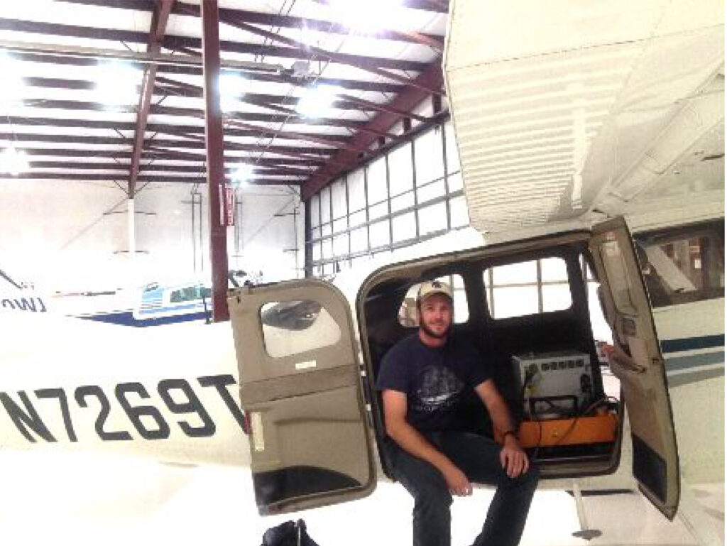
Maintenance days are conducted at the company’s hangar, where the pilots and operators clean and perform low level maintenance on the aircraft and the complex, 300-pound sensors and computer systems. Days at the office vary between training, managing databases and assisting the technicians with data processing of images and LiDAR data.
Central Wyoming College offers a complete degree in Geospatial Information Science and Technology, which is sufficient to enter the job market in nearly any related capacity. For students interested in becoming an Aerial Sensor Operator, the most useful courses are the Intro and Advanced GIS courses and, obviously, Remote Sensing. While a GIS degree is not required by most companies for entry-level Sensor Operators, understanding the science behind the GPS network, how aerial data collection for imagery and LiDAR works, and how that data is used to create finished products not only gives a candidate a huge advantage over competition, it gives them an advantage over their peers to collect higher quality data.
Working as an Aerial Sensor Operator is a very interesting, challenging and rewarding job for those who enjoy travelling and problem solving. The inevitable down-time created by adverse weather allows time to explore the new location one might never otherwise travel to, and the assistant work done in the office processing and organizing data can lead to a long career in the GIS field.
2660 Peck Avenue
Riverton, WY 82501
(307) 855 – 2000
Campus Map
120 Enterprise Blvd.
Lander, WY 82520
(307) 332 – 3394
Campus Map
240 S. Glenwood St #124
P.O. Box 4795
Jackson, WY 83001
(307) 733 – 7425
Campus Map
302 W. Ramshorn
P.O. Box 175
Dubois, WY 82513
(307) 455 – 2625
Campus Map
